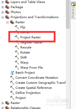
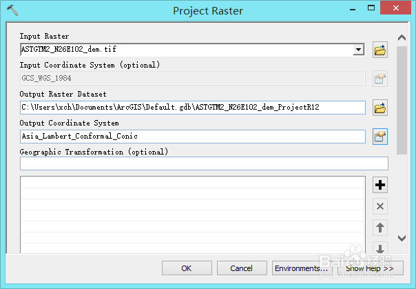
1、对DEM影像进行投影,重点是选择output coordinate system
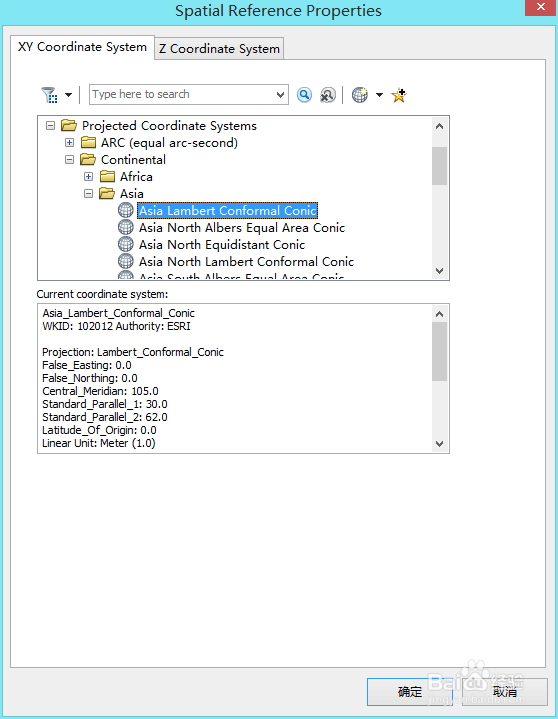
2、这选择中国常用的Lambert投影
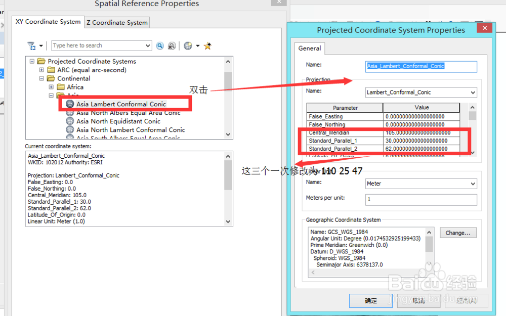
3、双击后,设置投影参数:中央经线110、第一标准纬度25、第二标准纬度47。设置完成后一路确定,得到重新投影后的选项
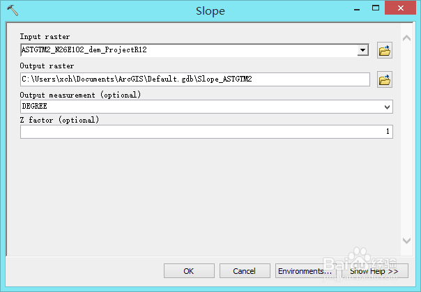
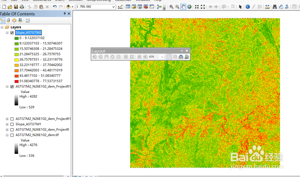
4、spatial analysis 中选择surface---slope计算重投影后的DEM影像坡度
1、对DEM影像进行投影,重点是选择output coordinate system
2、这选择中国常用的Lambert投影
3、双击后,设置投影参数:中央经线110、第一标准纬度25、第二标准纬度47。设置完成后一路确定,得到重新投影后的选项
4、spatial analysis 中选择surface---slope计算重投影后的DEM影像坡度